Johnson's Guide to Becoming an Outdoorsy Teen
Below you'll find info on local hikes, recommended gear, and other adventure ideas!
Here's list of brief outdoor adventures I would recommend this summer:
Day Hikes:
* = easy
** = moderate
*** = difficult
**** = epic suffer-fest
- Baldy*
- Mile-Hi *
- Blacktail**
- Roundtop**
- Vista***
- Mount Magnificent**
- 7-peaks**** (1-6 together on the same day. Start at Baldy and end at Mile-Hi. It’s a brutal day with lots of elevation gain/loss)
- Harp Mountain**
- Goldstar/POW Peak or Pepper Peak** (Accessed from Eklutna Valley)
- Gordon-Lyon* or Rendezvous Peak* (Arctic Valley)
- Government Peak** (Matsu)
- Lazy Mountain**
- Matanuska Peak *** (Matsu. Starts near Lazy Mountain trailhead. Tough hike, but worth it)
- Bird Ridge**
- Bear Mountain* (Peters Creek)
- Mt Eklutna** (Peters Creek. Hike back on the old road 1.5 miles until you see the sign. You can also climb Bear Mountain, take the ridge up the valley, climb Mt. Eklutna, and come back on the Mt. Eklutna trail)
- Caine’s Head** (Starts in Seward. You have to hike it at low tide to get to Caine’s Head, and hike back on low tide as well.)
- Slaughter Gulch*** (Kenai Peninsula. Epic views)
- (There are a ton of good day hikes and short backpacking trips in the front range east of Anchorage, but I simply haven't done many of them, though they are on my list for this summer!)
- Bold Peak.**** Semi-technical and the approach is from the East Fork of Eklutna River. Best accessed by ATV on the days they are allowed.
- Upper Winner Creek *** 14 miles round trip. Amazing views at the end. Haven't done this one either but plan to this summer.)
Backpacking trips with inexperienced friends:
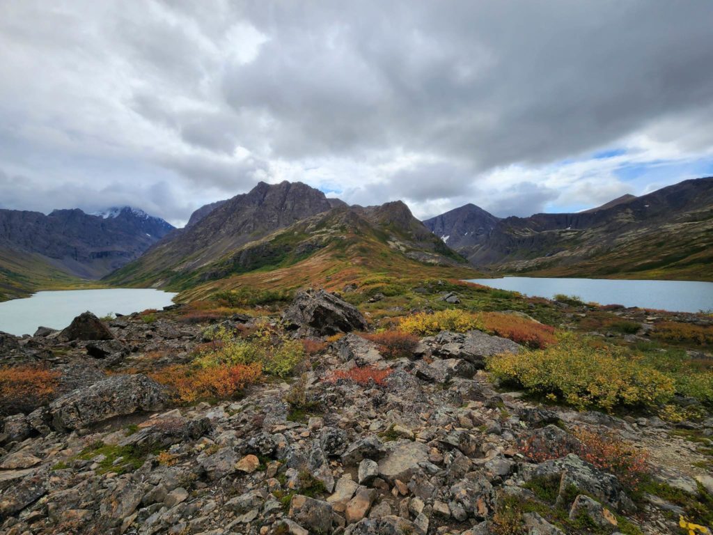
- Eagle and Symphony Lakes (My #1 suggestion for taking friends new to backpacking.)
- Reed Lakes (Hatcher Pass)
- Williwaw Lakes (start from Flattop trailhead)
- Hike/camp between Baldy and Blacktail. There are some ponds and small creeks up there for water. You can also start at Baldy, camp on the plateau between Baldy and Blacktail, and hike out down Ptarmigan Valley if you don't want to do a there-and-back trip.
- Johnson Pass** (Kenai Peninsula. Haven’t done it yet, but I hear it’s easy)
- Crescent Lake** (Kenai Peninsula. Haven’t done it yet)
- Caine’s Head** (Starts in Seward. You have to hike it at low tide to get to Caine’s Head and hike back on low tide as well. Haven’t done it yet, but know plenty of people who have. You can also kayak there and back instead.)
- Resurrection Pass***: This is a 45ish-mile trail from Hope to Cooper Landing. I would plan 3-4 nights. The trail is fairly easy. Camp near streams/lakes. You can also make it a shorter trip by coming in/out from Devil's Pass. You can also mountain bike the trail, which is way more fun. (The last 10 miles are mostly flat or downhill, but you’d need bikes set up for hauling/camping.) I would only do this one with moderately experienced friends, not beginners, since it’s kinda long.
- If you have access to ATVs, go to the end of Eklutna Lake and stop at the East Fork Eklutna River Trailhead. The trail is small and rough, and you have to follow game trails or walk along the riverbank once in a while. There are some incredible waterfalls back there. If you go five miles back to a large mound in the middle of the river valley, the views are life-changing. You could camp a night or two out there, but be back in time for ATVs to still use the trail (Sunday-Wednesday). Otherwise, it’s gonna be a long walk home!
Backpacking trips with experienced family/friends:
I’d definitely do this with someone who has hiked the trail before. It’s a five-mile uphill hike to the pass. The rest of the 20-something miles is downhill or flat, but not easy. The trail is rough and is occasionally difficult to find. There is a river crossing of Eagle River near where it comes out from the glacier. I would pack sandals to make the crossing easier. Link arms with your companions and unbuckle your waist belt on your pack in case you slip. Lots of bears on this trail too. You can do it in a day, 1 night, or two nights. If you do two nights, I would camp in the campsite a mile after the river crossing. (I think it’s called the Gorge or something.) If you do two nights, camp near the pass or Thunder Gorge the first night, and Twin or Heritage Falls the second night.
This is a ridge in Denali State Park that parallels the highway. I would do this hike when there’s clear weather. The views of Denali and the Alaska Range are stunning when the weather is nice. It’s a thirty-mile trail, and I’d take 3 nights to do it. You start from the Little Coal Creek Trailhead and end at Byers Lake Campground (will need to have a car waiting for you or parked at Byers Lake.) It’s a tough climb to the ridge, and then some fairly mellow of ups and downs along the ridge. Watch for bears. Also, watch for thunderstorms if it’s a nice day because you’re on the tundra and exposed on the ridge pretty much the whole time. Plan to spend one night near Ermine Creek. It’s more or less the halfway point, and there is a trail from there leading to the highway if you need to bail. There are some really cool granite monoliths to explore there. The hike down from the ridge to Byers Lake can get really slick after heavy rains, with steep cliffs nearby. (Also, don't let ground squirrels get into your food and eat your Chili Mac. Ask me how I know.)
- Hatcher Pass Hut Hop. (Advanced. Need to be okay with rocky scrambles and glacier travel. But you don’t need ropes or crampons)
Start at the Gold Mint trailhead in Hatcher Pass. On the first day, walk to the Mint Hut. The next day, hike to the Bomber hut. The next day, hike to the Snowbird hut. You walk out from the Snowbird hut to the Reed Lakes trailhead. I would only do this one if you’re with really experienced people, know the locations of the huts, and are comfortable with steep trails and scrambles and walking on glaciers (very few crevasses). I think you need to be a member of the American Alpine Club and/or the Alaska Mountaineering Club to use some of the huts (but no one is going to check.) Also, the huts are first-come, first-served, so you probably need to bring a tent or bivy sack to sleep outside if the hut is full. Reach out to me if you want more info on this one.
Rock Climbing:
Go to the Alaska Rock gym and get certified in top-rope climbing. Climb and boulder there.
There’s a great book called “The Scar” that has climbs in southcentral, mostly along Turnagain Arm, Hatcher Pass, and along the Glenn Highway north of Chickaloon.(I wouldn't start rock climbing outside until you’ve taken a class, bought all your needed climbing gear, and go with experienced, trusted friends.)
Random Ideas:
- A walk to the mouth of Peters Creek. There’s a municipal park and a trail. Short walk, but nice being near the ocean and has a nice view of upper Cook Inlet! Stay off the mud flats. (Off of Stolze Rd. in Chugiak)
- Beach hike/day at Beach Lake. Hike or paddle to the far end of Beach Lake. You’ll see a trail going down to the beach. You can walk a mostly gravel beach if you head left (south). Watch for bears. Don't go on the mud flats.
- Gold prospecting. Bertha Creek near Turnagain Pass. There's a campground there, and the recreational gold mining area is upstream of the highway. There’s also a good spot in Petersville, but reach out if you want to do that one. There are lots of private mining claims around.
- If you’ve never been to Matanuska Lake, there’s a cool island, a dock you can jump off of, and some rope swings from trees (past the island). It’s a cool spot but doesn’t have much of a beach other than on the island, which you can hike to from the parking lot. Take the trail that wraps the lake counterclockwise. Watch out for sketchy Valley dudes.
- Float trips:
- Eagle River: Be very, very careful of sweepers and log jams. Best to do this when the water level is lower. Put in at North Fork and take out at Briggs Bridge. Day trip.
- Little Susitna: 3-day, 2-night trip at least. A fairly mellow (and at times shallow) river. Do it early in the year when there are few motorized boats on the river, which is quite narrow.
- Knik (Put in at the Old Glenn bridge and take out at New Glenn bridge. Mellow and slow. Stay in the main channel. Watch for motorboats.) Day trip.
- Berry picking
- Red currants and raspberries starting in late July
- Blueberries starting in mid-August.
Johnson's Guide to Becoming an Outdoorsy Teen: Gear
Alright, y'all. This will be an ongoing series. However, for those of you who want to get outdoorsy, here's a few first steps you can take.
Gear:
In the summer, even for day hikes, you need to bring the following things:
- A weatherproof shell
- Alaskan weather can change quick. Even a stop at the top of a peak on a sunny but windy day can get you chilled quick. Find something that's lightweight, windproof, and preferably waterproof.
- Water!
- Getting dehydrated sucks. If you seriously sweat like me, consider even more water or a water filter or life straw.
- An extra layer + a hat
- A wool sweater is your best bet here. It keeps you warm even if its wet, and it breathes better than any synthetic fabric. Find a thick sweater. It's easy to find ugly, thick wool sweaters at thrift shops. That extra layer can often, literally, save your life. Imagine you're 6 miles back and you break a leg. It's going to be hours before rescuers can get to you. A wool sweater and a weatherproof shell will be the difference between a bad day and a potentially profoundly shitty day. Same goes for a hat.
- Bear spray
- Practice using it with an older can of spray. As you are walking, practice taking it out quickly. Like firearms, it's only effective if you have done a ton of practice and are proficient with it. (It's also good for creepy men.)
- A partner
- Speaking of creepy men, it's always best to hike with a partner. If someone gets hurt, you'll need someone to find help. If they are carrying layers and someone gets hurt, you can share layers and other items.
- Snacks
- Because snacks. Also, when you're in the middle of a suffer-fest, you'd be amazed at how a granola bar or Jolly Rancher can lift your spirits.
- Bug spray
- Bad mosquitos or flies can ruin an otherwise idyllic hike.
- A Garmin GPS
- Lots and lots of places just outside of town have no cellular coverage. This can literally save your life. They're not that expensive, and the subscriptions aren't either. Tell you parents that if they love you, they'll buy you one.
The hikes below are generally flat and offer a great first step into hiking and getting into nature! These areas also offer both shorter and longer hikes. The trails are wide and well-maintained. They are also popular trails, so while wildlife encounters are certainly still possible, there is enough human traffic to reduce the chances of meeting something large and hairy.
Eagle River Nature Center
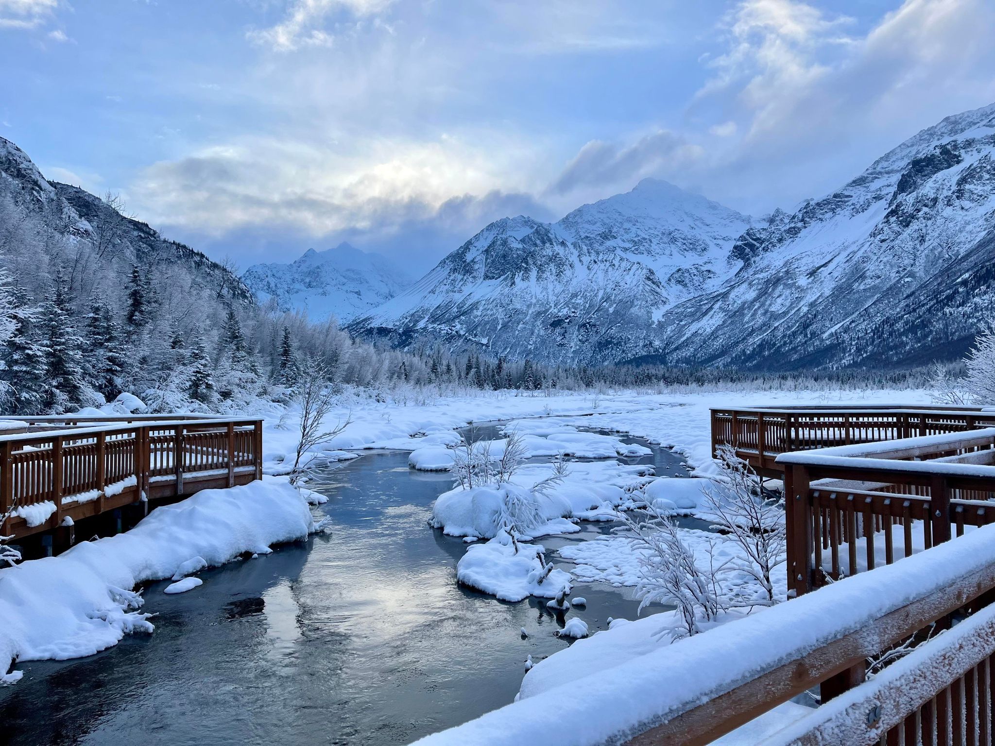
Located at the end of Eagle River Rd, this trail system is the also the end of the Crow Pass Trail. It has a cute visitor's center and offers cool classes throughout the year. The smallest loop brings you to a creek/pond with an extensive boardwalk where you can see salmon spawning in the fall. You can always hike the Crow Pass trail as far as you'd like. There are some rapids to view about two miles in, and Echo Bend is three miles in. "The Perch" and Heritage Falls are about a 3 and 4-mile hike respectively (1 way) and offer amazing views. There is also the Dew Mound and Albert loops trails. The Albert Loop trail typically closes in midsummer because of bear concerns, as the trail crosses several salmon streams. Be bear aware! There are lots of bears out there. Make noise, go in a group, and bring bear protection. Cabins and yurts are also available to rent along the trail, but you need to get reservations early.
South Fork Eagle River (Hiland Valley)
This trail is up near the end of Hiland Road. Once you get near timberline, follow the signs to the trailhead. The trail is generally level and is above timberline, so views and berries abound! You can also do some longer hikes here. Eagle and Symphony Lakes are about 6 miles back on an easy trail. There is also a hanging valley to the east with a side trail leading up to beautiful peaks and a small lake.
This is a great place for your first backpacking trip! The trail is mostly flat, the views are incredible, and I've rarely seen bears back there. Be aware you need to cross a boulder field once you get to the lakes. Look for "cairns" (piles of stones) to find the easiest way through. The best camping is on the ridge between the two lakes or towards Eagle Lake (the one to the east) after you cross the boulder field.
Thunderbird Falls
This one is my least favorite. The trail only goes about a mile back and ends at a fairly unimpressive waterfall. Before you reach the end of the trail, where there is a view platform you can hardly see the waterfall from, take the side trail to your left heading down to the creek, where you can get closer to the base of the falls. The first half of the hike borders a subdivision, so you see people's backyards for half the hike. The trail also often has lots of people.
Eklutna Lake
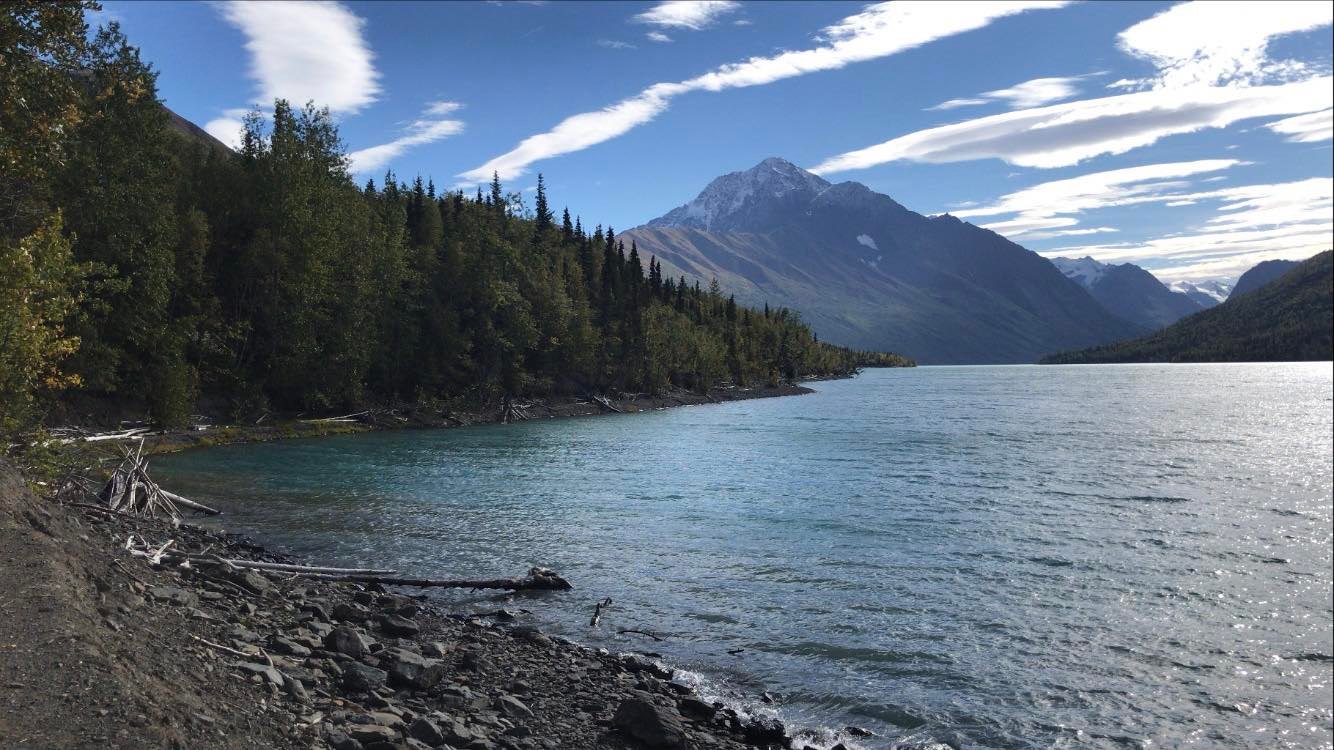
Instead of Thunderbird Falls, go all the way back on Eklutna Lake Rd to the end. There is a big campground at the foot of the lake. A trail follows the lake shore and beyond. It ends about 12 miles back. This is also a great place to bring bikes. Be aware motorized vehicles are allowed on the trail several days a week, which kinda ruins the quiet nature walk. The views are amazing the whole way. Other moderate hikes are also nearby. This tends to be an annoyingly popular spot on warm sunny days. Be aware that the lake is very, very cold. Sudden strong winds also affect the lake, so if you are doing any water sports, be very, very careful. In the winter you can skate on the lake ice if we have a cold winter with delayed snow, but be careful. The lake is used as Anchorage's water supply, and rising and falling lake levels can make the ice unstable.
Arctic Valley
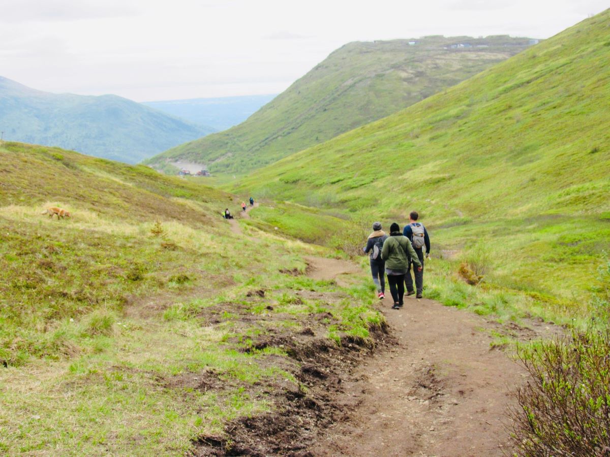
Take the Arctic Valley exit and drive east. The dirt road winds way up the mountainside, and you begin your hike on the tundra at the base of Arctic Valley Ski Area. The easy, wide trail ascends gently to a pass with excellent views of the mountains near Eagle River. Once you get to the pass, you can turn right and ascend Mt. Gordon-Lyon. If you take a right, you can climb Rendezvous Peak. This is also a very popular trail on nice days and during berry season. Be aware that the military closes the gate and the bottom of the road at 9 or 10pm, so make sure you are out of there in time. Also, the parking lot is run by the ski resort, so you will need to pay for parking even if you have an Alaska State Parks parking sticker.
These hikes are great starter hikes for people looking to "climb" mountains instead of hiking level trails.
Other websites to explore local hiking options:
Mt. Baldy
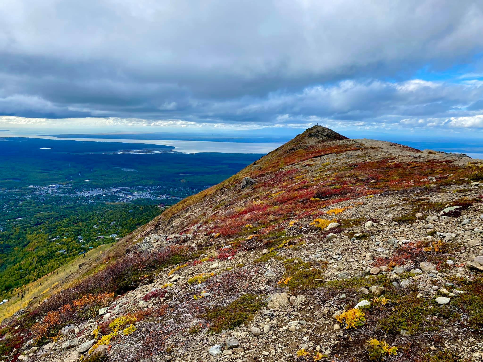
This is the most popular hike in the Eagle River area. Take Skyline Dr. to the very end of the road (the road name changes a few times on your way up; just keep going straight on the main road. You will arrive a the end of the road with two gates -- one at the end of the road, and one angling uphill. Park on the south side of the road. The trail is generally broad and easy. However, near the top of the mountain, the trail gets a lot steeper with some loose rock. This is a great, easy "climb" to start with. Because there are always plenty of people on the trail, wildlife or other dangers are minimal.
Harp Mountain
This is a substantial hike with a fairly relentless climb. Drive to the end of Hiland/South Fork Valley by turning onto Hiland Dr. When you see the sign/turn for the South Fork trailhead, keep going straight until the road ends at a culdesac. Park on the uphill side. Watch for "no parking" and "private property" signs. Harp Mountain is the major peak to your east. Take the ridge to your south all the way to the top. The views are incredible! However, be aware that while you can hike this peak in the winter, and many do, Harp Mountain can have avalanche dangers.
Rendezvous Peak and Mt. Gordon-Lyon
These two small peaks are to the right and left, respectfully, as you reach the end of the Arctic Valley trail. Both peaks are easy climbs. For more information on Arctic Valley, check out this post.
Gold Star Peak
I haven't done this one (yet), but I've heard it's a good one! It's in Eklutna valley. Find more info here!
Bear Mountain
Take the Peters Creek exit. Right of the exit onto Ski Rd. Follow until the road comes to a "T." Turn right. Follow the main road all the way up. You'll see a trailhead sign at the end of Malcom drive. Go through the gate and you'll find yourself on a wide, old roadbed. Go another 100 yards or so and you'll see a trail heading up the mountain to your left. Be aware that the first portion of the trail crosses private property. In fact, the owners built a cabin near the trail. Follow the path. The second half of the hike is steeper and will give you a good workout. Once you get to the top, you'll be on a big plateau. If you go west, you can hike to a point overlooking Peters Creek and the Matsu Valley. If you head east, you can access Sawtooth and Eklutna Peaks. I like this trail because it's near my house and is far less traveled than the Baldy trail.
Mile-Hi
Mile-Hi is an unimproved trail that starts on the north side of Eagle River Valley. To get there, take either Steward Dr or Mile Hi Ave. Continue up the steep, switchback roads until you find the trailhead near the end of the road. The trail goes up into a saddle of the ridge. From there, you can do a short hike onto the ridge on your left. If you take a right, the trail follows the ridge to Mt. Tucker and Mount Magnificant. Mt. Tucker is an excellent hike with astounding views. The approach to Mount Magnificent includes a narrow, steep ridge, and is probably not best for newer hikers.
Twin Peaks Trail
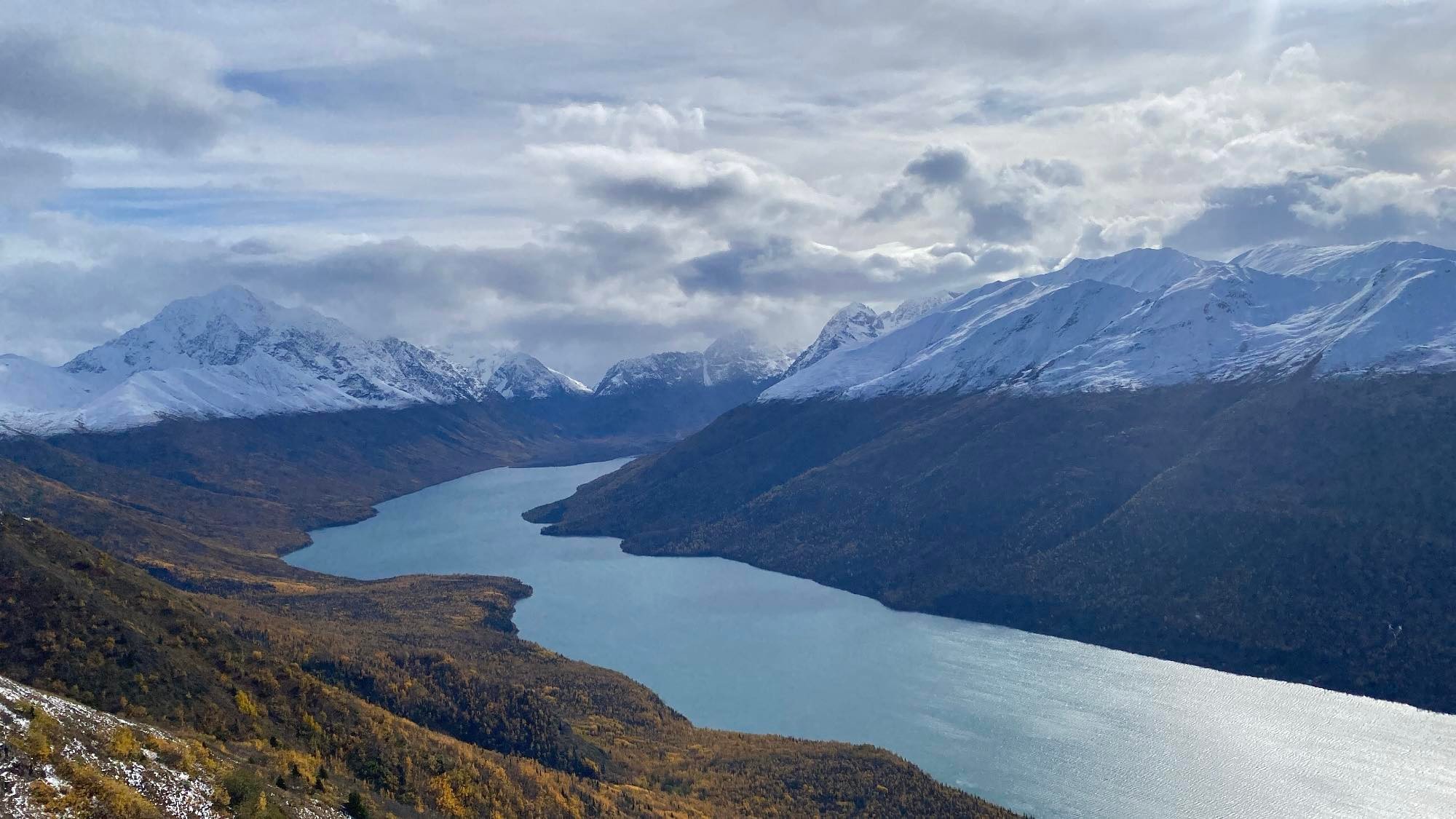
This trailhead starts near the Eklutna Lake campground. The trail works its way up the mountain towards Twin Peaks, which you really shouldn't climb without lots of experience. Halfway up the trail is the beginning of Pepper Peak, which is a manageable hike. Once you get above the treeline, the views are phenomenal!
